

You can find on this page the Dublin topographic map to print and to download in PDF. The Dublin elevation map present the topography, river and relief of Dublin in Leinster - Ireland.
The Dublin topographic map shows elevation, hills and landforms in Dublin. This elevation map of Dublin will allow you to know topography, river and relief of Dublin in Leinster - Ireland. The Dublin topographic map is downloadable in PDF, printable and free.
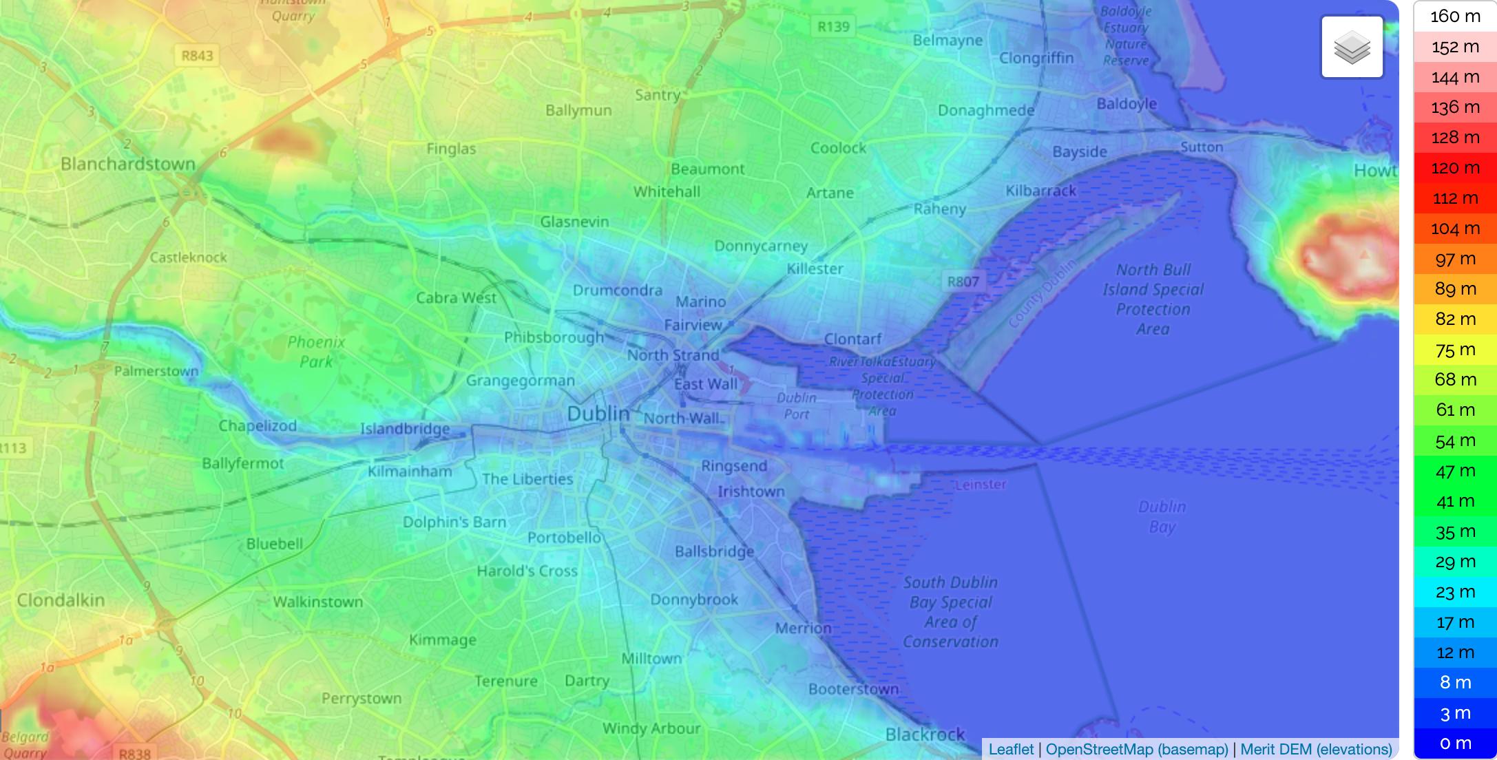
Dublin is situated at the mouth of the River Liffey and encompasses a land area of approximately 115 km2 as its shown in Dublin elevation map. It is bordered by a low mountain range to the south and surrounded by flat farmland to the north and west. The Liffey divides the city in two between the Northside and the Southside. Each of these is further divided by 2 lesser rivers, the River Tolka running northwest from Dubin Bay, and the River Dodder running southwest from the mouth of the Lifrey. Two further water bodies - the Grand Canal on the southside and the Royal Canal on the northside - ring the inner city on their way to the west and the River Shannon The Liffey bends at Leixlip from a predominantly east-west direction to a southwesterly route, and this point also marks the change from urban development to a more agricultural land usage.
Dublin coordinates: 53.29873 -6.38703 53.41054 -6.11488. Minimum elevation: 0 ft. Maximum elevation: 1,536 ft. Average elevation as you can see in Dublin elevation map: 177 ft. Dublin elevation map of Dublin,Ireland, which displays range of elevation with different colours. The elevation map of Dublin, Ireland is generated using elevation data from NASA 90m resolution SRTM data. The maps also provides idea of topography and contour of Dublin
More than 40 percent of Ireland population is centered around the city of Dublin, which has an elevation of 85 meters (279 feet) as its mentioned in Dublin elevation map. This coastal city is located in eastern Ireland, at the mouth of the Liffey river. There are some low mountains to the south of city, but they only rise to around 450 meters (1475 feet). Peaks in South Dublin include Kippure 2,470 feet to the North, to the West is the Seefingan Mountain 2,364 Feet, Ballinescorney, Ballymorefinn 1,689, Corrig 2,055, Slievenabawg 2,055 feet and to the east the main hills are Glassmuckey, Piperstown and Montpellier -also know as the Hellfire Club.